10-Chapter Dubai Atlas Maps Emirate Growth and Future Urban Plans
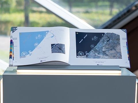
Dubai Municipality has launched the Dubai Atlas, a 10-chapter geographic and visual publication documenting the emirate’s spatial transformation from its earliest historical cartography to its future urban master planning. The comprehensive record provides urban planners, infrastructure developers, and municipal service agencies with detailed geospatial data, satellite imagery, and aerial mapping to manage city growth and natural resources.
Historical Archive Meets Future Digital Twin Models
The new publication consolidates data across 10 distinct subject areas, including demographics, transportation networks, environmental zones, cultural landmarks, healthcare facilities, education, and religious sites. It also incorporates visual documentation of Dubai’s natural environment, detailing nature reserves, agricultural land, ghaf tree conservation zones, dams, mountain trails, and food security infrastructure alongside historic municipal maps.
Urban planning authorities and emergency services utilize the integrated spatial data to inform road network design, traffic analysis, building construction permitting, and environmental monitoring. The mapping framework integrates emerging municipal technologies, linking geographic information to digital twin systems, artificial intelligence, and spatial risk analysis for crisis response.
Eng. Maryam Al Muhairi, CEO of the Building Regulation and Permits Agency at Dubai Municipality, stated that the publication establishes geospatial data as a central framework for city planning and operational management. She noted that combining visual history with digital twin technology supports resource management, enables proactive decision-making, and strengthens the emirate’s ability to anticipate future urban challenges.
The release coincided with the 25th anniversary of Dubai Municipality’s Geographic Information Systems (GIS) Centre during World GIS Day proceedings held on November 18, 2026. The milestone marks two and a half decades of centralized spatial mapping developments, transitioning paper records into interconnected digital frameworks used across local government entities.