Dubai Police Launch AI Mapping Tool to Target Three-Minute Responses
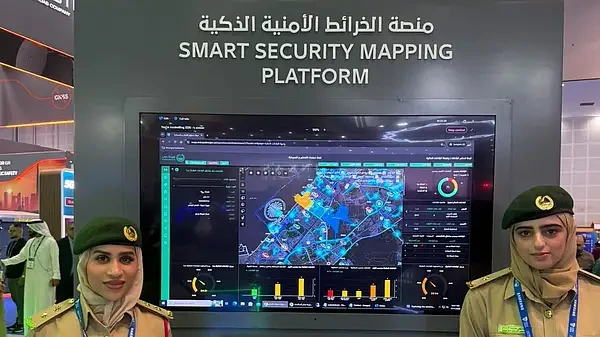
Dubai Police debuted an artificial intelligence-powered Smart Security Mapping Platform at the World Police Summit on Tuesday, November 17, 2026, designed to streamline emergency response routes and redistribute field coverage dynamically. Emergency response teams and field operators are utilizing the new system to track live incidents, evaluate access roads, and adjust patrol boundaries in real time when standard routes face traffic obstructions.
Developed using geographic information systems technology from Esri, the platform displays active reports alongside current vehicle locations. Second Lieutenant Hessa Al Muhairi stated during the presentation that the system processes live feeds with timestamps matching ongoing events to assist units in navigating complex urban environments.
The technology supports a strict three-minute emergency response target. By evaluating incident patterns, population density, and traffic density, the platform generates optimized travel routes and recommends specific positioning points where idle units can maximize their coverage area.
When a primary patrol is engaged with another call, the software alters coverage boundaries to divide the affected zone into smaller sections, allowing neighboring patrols to assist. Operators monitor these shifts and unit availability through color-coded status indicators on the interface. The mapping framework also incorporates aerial resources, assigning specific geographical zones to drones to mirror ground patrol distributions and maintain comprehensive oversight across urban sectors.